
In the aftermath of the earthquake and tsunami in Japan, Google Earth have released satellite images of some of the affected areas. Not all images are very clear, but tell a striking tale nevertheless. Here are some of the airfields I tried to cover in my previous blog post.
Sendai:
The first image shows the main runway and civil terminal. Damage is obvious but not many wrecked aircraft, if not any, are visible here. The faint white line crossing the images is a condensation vapour trail from an aircraft passing high overhead the airfield at the time these images were taken, on Google Earth you can actually follow the trail to the southwest and spot the culprit!
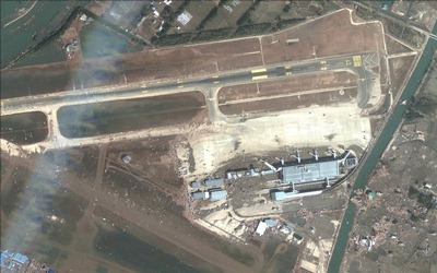
More can be seen at the southern side of the airfield, here is where the row of hangars is situated, with companies like JAMCO (the large hangar in the lower right of the image) and the JMSA (Coast Guard, the blue hangar in the top left of the image). Lots of damage visible here, although image resolution is not high enough to really identify any aircraft, one exception being the preserved Mu.2 somewhere in the middle of the image.
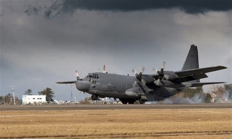
With US assistance, part of the runway was cleared and re-opened for relief operations. The first fixed wing aircraft to land was a US Special Forces MC-130H:
Matsushima AB:
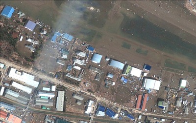
Unfortunately the image quality is not very good, but does show some kind of clearing has been done. It looks like some of the F-2B‘s we saw parked on the platform earlier have been moved, also the F-2B and one of the T-4‘s pushed against the buildings by the tsunami have been removed.
The JASDF (Air Force) had declared the airbase back in operation as of March 15. This was a bit premature though, as it was only the next day that the highly-trained aircrew of a US MC-130P Combat Shadow was able to land the special operations aircraft even though the air traffic control was not up and running. Immediately after landing, equipment and vehicles were offloaded to re-establish the Matsushima and Sendai runways.
I think it is safe to say it is not very likely we’ll be seeing any operational flying for some time to come.
Hachinohe AB:
Only a single, mostly cloud obscured, image, but it does show the airbase intact with two neat rows of P-3C Orions on the platform.
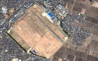
Kasuminome AAB:
Contrary to reported earlier, it now seems clear the airfield was NOT heavily flooded, looking at the state of the airfield, lack of debris and farmland next to the base still neatly ploughed. Therefore we can safely conclude no aircraft were damaged by the tsunami. By the amount of helicopters visible on the image below it is obvious the airbase is a busy place now.
I am curious if you can find any other aviation-related images I might have missed, let me know!
Marco